




UK Offline Road Map - OS Based

وصف لـUK Offline Road Map - OS Based
OS (Ordnance Survey) offline map atlas of Great Britain.
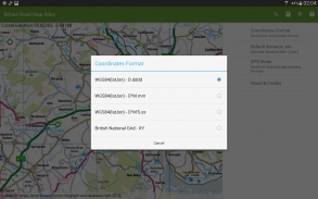
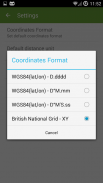
British National Grid coordinates as an option to standard latitude, longitude.
UK Atlas covers England, Wales, Scotland, Orkney, Shetland, Western Isles, Isles of Scilly and Isle of Man. Northern Ireland and the Channel Islands are not covered by this application.
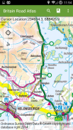
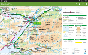
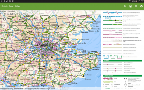
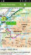
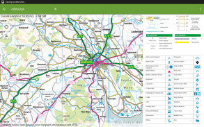
Application provides a regional view of the landscape which is similar in content and appearance to a typical road-atlas.
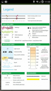
On the map you can browse:
- Cities, towns, villages, centres of population,
- Motorways and junction numbers, A and B roads,
- Railways,
- Rivers,
- Some woodland features and wind farms location.
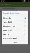
The app is ideal for route planning and geographic context. You can show/follow your current location and calculate distance between points using 'tap' action.
With this app you do not need the paper atlas any more. You will get same level of details - popular OS 1:250K scale and you will be able to check alternative routes just in few seconds.
The application provides support for geographic and British National Grids coordinates - set your default format in settings.
You always know where you are and how to get to your destination.
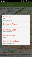
UK Map Atlas contains 1:50 000 Scale Gazetteer which is a GB reference tool and location finder containing 250,000 distinctive place and feature names.
Contains Ordnance Survey Open Data © Crown copyright and database right 2015.
</div> <div jsname="WJz9Hc" style="display:none">OS (المساحة) حاليا خريطة أطلس لبريطانيا العظمى.
تنسق الشبكة الوطنية البريطانية كخيار لخط العرض القياسية، والطول.
المملكة المتحدة أطلس يغطي إنجلترا، ويلز، اسكتلندا، أوركني، شتلاند، الجزر الغربية، جزر سيلي وجزيرة آيل أوف مان. لا تغطيها أيرلندا الشمالية وجزر القنال بواسطة هذا التطبيق.
يوفر تطبيق نظرة إقليمية من المشهد الذي يشبه في المحتوى ومظهر لنموذجي الطرق أطلس.
على الخريطة، يمكنك تصفح:
- المدن والبلدات والقرى والمراكز السكانية،
- الطرق السريعة وأرقام تقاطع، A و B الطرق،
- السكك الحديدية،
- الأنهار،
- بعض الميزات الغابات ومزارع الرياح الموقع.
التطبيق هو المثل الأعلى للتخطيط الطريق والسياق الجغرافي. يمكنك إظهار / متابعة موقعك الحالي وحساب المسافة بين نقطة باستخدام العمل "الصنبور".
مع هذا التطبيق لا تحتاج الأطلس ورقة أي أكثر من ذلك. سوف تحصل نفس المستوى من التفاصيل - OS شعبية 1: نطاق 250K، وسوف تكون قادرة على التحقق طرق بديلة فقط في بضع ثوان.
يوفر تطبيق الدعم للالبريطانية الجغرافية وشبكات الوطنية إحداثيات - تحديد التنسيق الافتراضي الخاص بك في الإعدادات.
تعرف دائما أين أنت وكيف للوصول الى وجهتك.
المملكة المتحدة خريطة أطلس يحتوي 01:50 000 مقياس المعجم الذي هو أداة مرجعية GB والموقع المكتشف يحتوي على 250،000 مميزة مكان وميزة الأسماء.
يحتوي المساحة البيانات المفتوحة © حقوق الطبع والنشر ولي العهد وقاعدة بيانات الحق عام 2015.</div> <div class="show-more-end">


